Utilizing ‘Big Data’ and ICT innovations

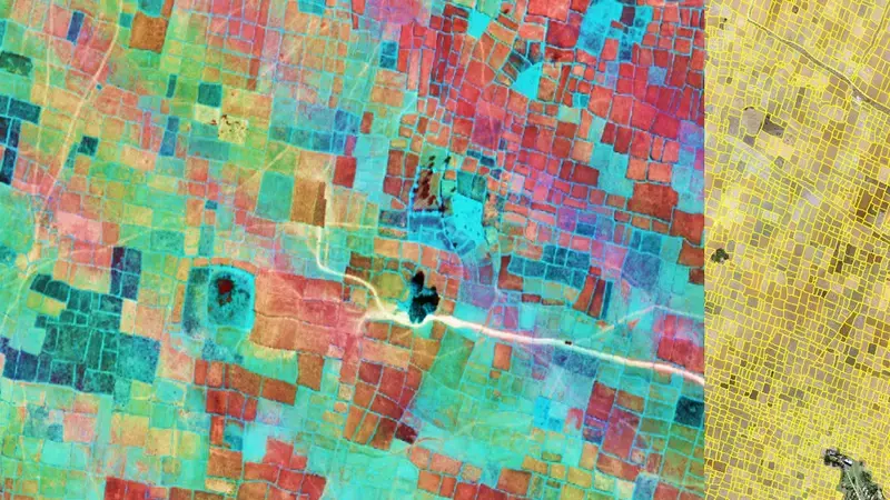
Geo-informatics, remote sensing, and the outpouring of data from molecular research and the field can be used in multiple ways - from real-time maps of crop productivity, and water consumption; to the more accurate targeting of genetic improvements in breeding programs.
Properly executed, they help enhance the efficiency of research, improve the precision of agricultural interventions, and guide effective and appropriate policymaking. ICARDA’s geo-informatics platform (GeoAgro) offers spatial solutions for integrated agro-ecosystems. It quantifies complex system dynamics and drivers which help ICARDA more effectively target site-specific ecological intensification.
Field data collection tools and open data kits aid the geo-localization of our research – helping with the scaling and measurement of our impacts. We also know that big data and technological innovations can be more valuable if they are shared with others, and for this reason, ICARDA is committed to open access and extensive cooperation with external partners, including the CGIAR Big Data Platform.
Monitoring the loss of agricultural land in Yemen
The application of geo-informatics and big data can play an extremely important role in fragile and inaccessible areas where scientists may find it difficult to collect the data they need to implement targeted interventions. In conflict-affected Yemen, ICARDA - with World Bank support - is using high-resolution satellite imagery to produce digital maps, reports, and statistics that demonstrate changes in agricultural production and productivity.
An analysis of satellite images over the period 2014 to 2017 revealed that 54 percent of observed areas experienced a decrease in crop production – of which 76 percent also experienced declining rates of crop productivity. Initial impact assessments have helped to identify additional hotspots of abandonment in Taizz, Zabid, Bayt al Faqih, Al Hudaydah, Bajil, and Hajjah.
This data is critically important in a country where two-thirds of the population depend on agriculture for their livelihoods, and a complex emergency is threatening to cause widespread famine, according to warnings from the World Food Program. Hazard risks, including frequent droughts and locust outbreaks, are compounding the vulnerability of Yemenis – of which 8.4 million are now deemed severely food insecure and entirely reliant on external assistance. Mapping the status of agricultural landscapes at higher spatial details before and after the impacts of the current conflict will help to identify the investments needed to address food security once peace has resumed.
Sustainable intensification of rice fallows with pulses
In India, ICARDA has developed a geoinformatics-based decision support tool that targets sustainable pulse intensification in rice fallows – a critical solution in a country where demand for nutritional food grains continues to rise, but additional arable land is becoming increasingly scarce. This digital interactive map can show the length of fallow duration, the start and end of fallow periods, their seasonality, and cropping intensity.
By analyzing the remote sensing data it is possible to identify potential areas where high-yielding, short- or long-duration legumes and other corps can be grown in rice fallows. The tool helps farmers, researchers, and policy makers to fine-tune their decisions and actions while also supporting the implementation of a holistic strategy that combines appropriate water and land management strategies, improved early maturing crop varieties, agricultural inputs and enhanced market access. The result: a reliable supply of livestock fodder, higher incomes, and positive benefits for local ecosystems.
